Datei:Indian revolt of 1857 states map.svg

| Titel |
Indian states during Revolt of 1857 |
|||||||||
| Beschreibung |
Map showing the Indian princely states during the w:Revolt of 1857.
|
|||||||||
| Legende |
 |
|||||||||
| Datum | ||||||||||
| Quelle |
Eigenes Werk |
|||||||||
| Urheber |
|
|||||||||
| Genehmigung (Weiternutzung dieser Datei) |
Ich, der Urheber dieses Werkes, veröffentliche es unter der folgenden Lizenz:    Diese Datei ist unter der Creative-Commons-Lizenz „Namensnennung – Weitergabe unter gleichen Bedingungen 3.0 nicht portiert“ lizenziert.
 The frontiers depicted on the Indian maps in Wikipedia are from a neutral point of view and may differ from official government maps of India, Pakistan and China. Please consult local laws governing publication of maps before usage. The frontiers depicted on the Indian maps in Wikipedia are from a neutral point of view and may differ from official government maps of India, Pakistan and China. Please consult local laws governing publication of maps before usage. |
|||||||||
| Kartografische Angaben | ||||||||||
| Abgebildetes Datum | zweite Hälfte 20. Jahrhundert und 21. Jahrhundert | |||||||||
| Koordinatenbezugssystem | conic | |||||||||
| Räumliche Begrenzung |
|
|||||||||
| Georeferenzierung | Wenn das nicht passt, setze einfach warp_status = skip, um es auszublenden. | |||||||||
| Archivalische Angaben | ||||||||||
| Bemerkungen | Part of WikiProject India Maps | |||||||||


![[1]](http://www.history.upenn.edu/coursepages/hist086/material/schmidt38a.jpg)


Notes
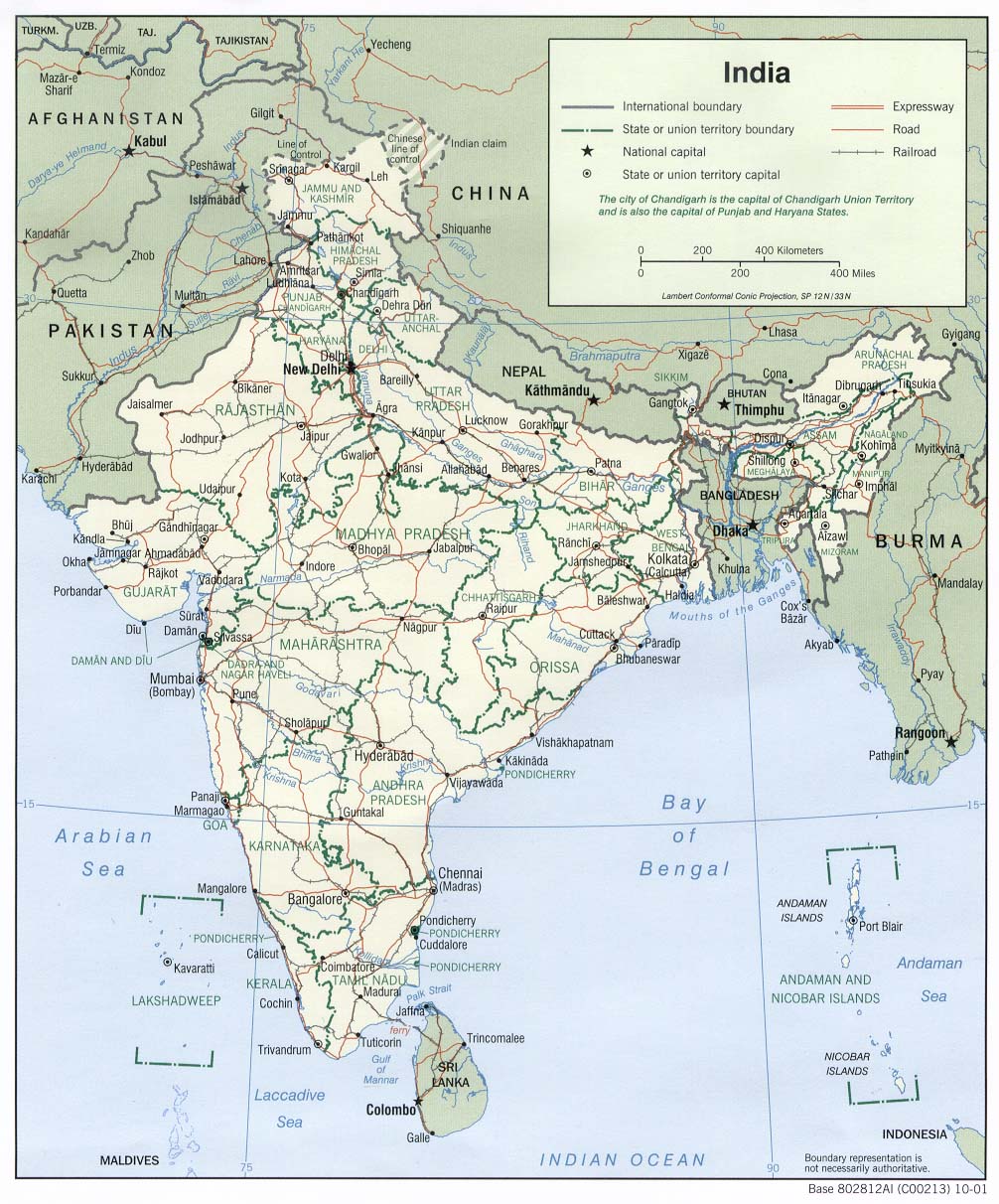
Depiction of India's borders
- The territorial boundaries of India are shown as per the actual ground situation in accordance with international practices followed by the United Nations ([2], [3]) and the National Geographic Society ([4], [5])
- This map is meant to be for illustrative purposes only and is not authenticated by official government sources. Please check the list of sources and references used to create the map for a measure of accuracy and verifiability.
- The usage of these maps in India, Pakistan and China is governed by different laws that restrict depictions of boundaries other than what is officially recognized by the state. Please check local laws and modify the map accordingly before use.
Explanation of disputed boundaries


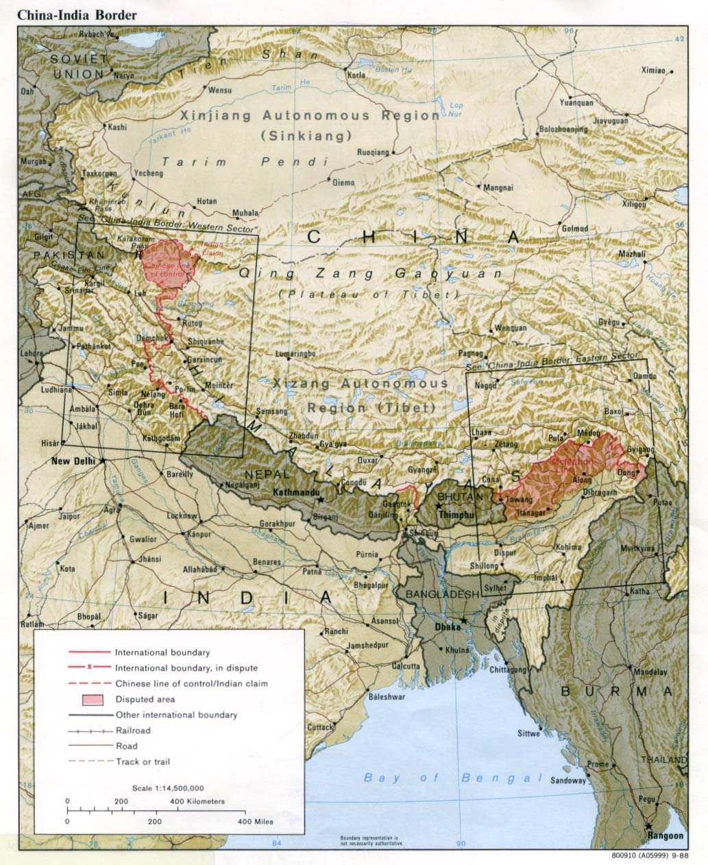
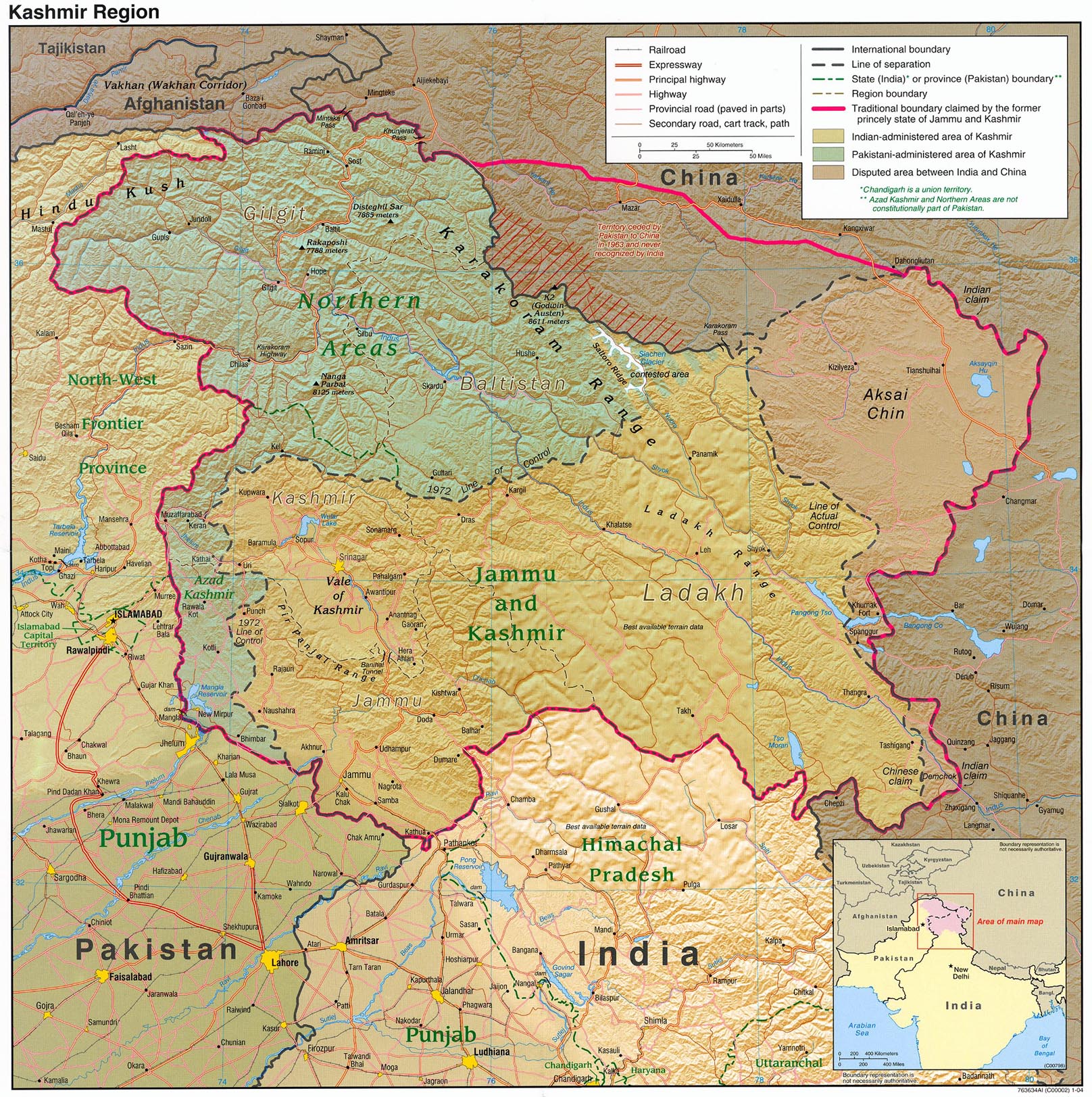
- Boundary of Indian claim : The territory India claims is legally theirs, but the claim is disputed by China and Pakistan.
- Line of Control/Line of Conflict : The de facto administrative boundary recognised by the international community. This UN ceasefire line is considered as a temporary solution to the ongoing conflict since the departure of the British Raj.
Borders of disputed regions
The depicted extent of the former territory of the British Indian Empire, succeeded by Republic of India, may not be accepted by a few countries as legal due to ongoing border disputes:
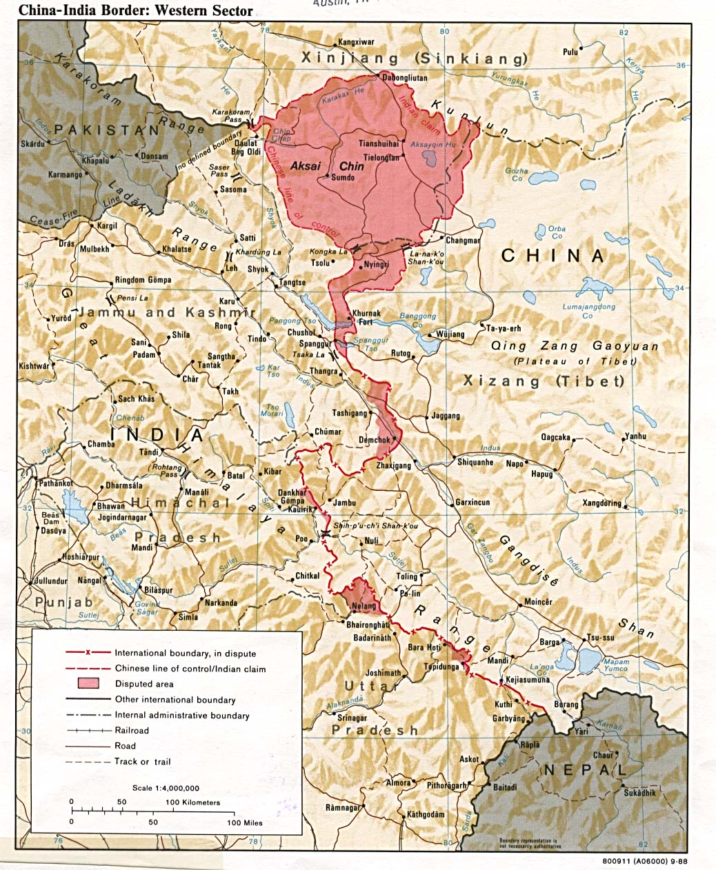
- The northern Himalayan region of the disputed territory Indian-administered Kashmir is claimed by India including Pakistan-administered Kashmir and the Chinese-occupied territory of Ladakh plateau. Since 1972, it is divided between all three countries. See also Line of Control and Line of Actual Control.
- Siachen glacier (shown in white) is an actively contested region between India and Pakistan. Since 1984, the region is under Indian control.
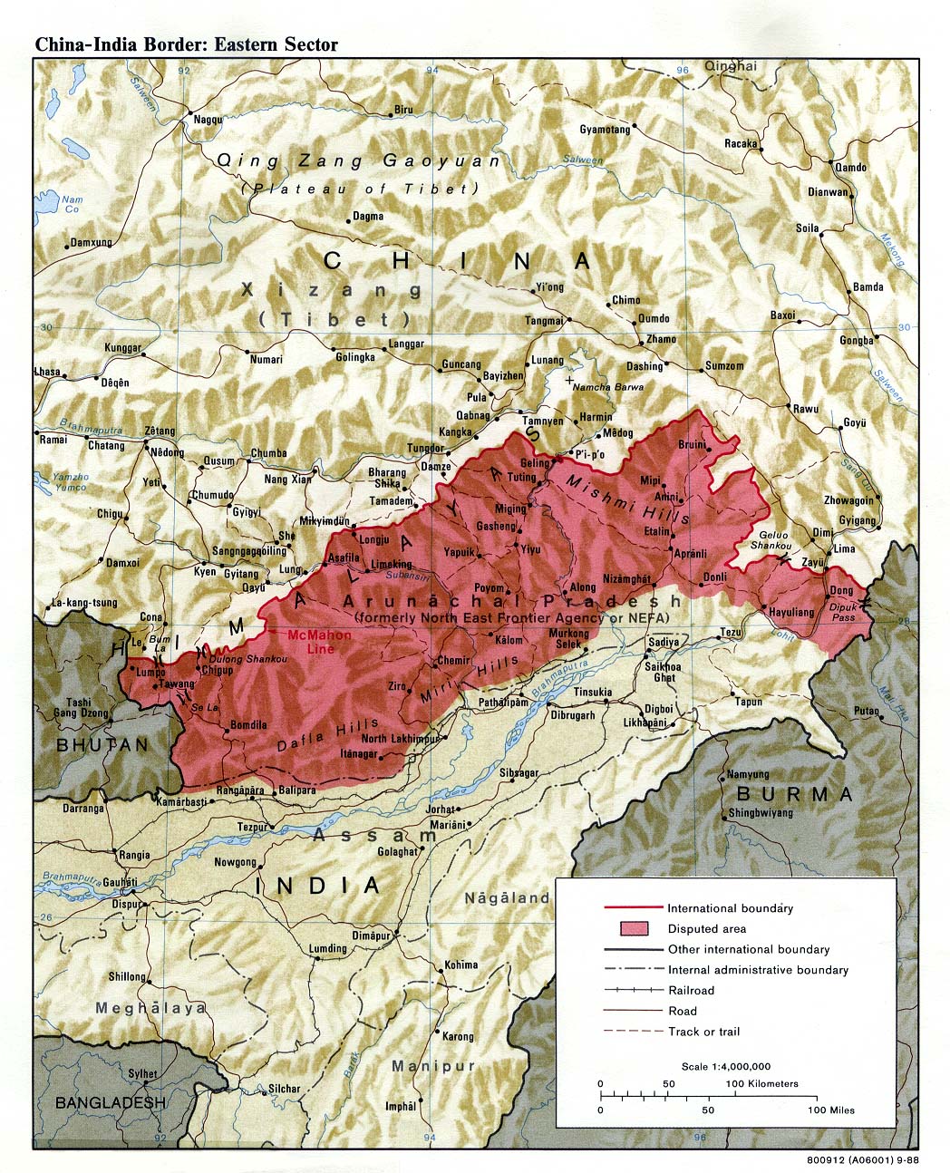
- The northeastern territory of Arunachal Pradesh is almost entirely claimed by China as part of its Tibetan territory.
- Minor areas of eastern Kashmir's Ladakh division, Himachal Pradesh and Uttarakhand on the Chinese frontier are claimed by China. These areas are under Indian control.
- A small area of Uttarakhand adjoining the Nepal border along the Sarda river is disputed between the two countries.
For a detailed map of all disputed regions in South Asia, see Image:India disputed areas map.svg
Internal borders
The borders of the state of Meghalaya, Assam and Arunachal Pradesh are shown as interpreted from the North-Eastern Areas (Reorganisation) Act, 1971, but are yet to be verified.
Territorial waters
The limit of the territorial waters of India extends to twelve nautical miles measured from the appropriate baseline. See this for more information.
Dateiversionen
Klicke auf einen Zeitpunkt, um diese Version zu laden.
| Version vom | Vorschaubild | Maße | Benutzer | Kommentar | |
|---|---|---|---|---|---|
| aktuell | 11:58, 7. Nov. 2007 | | 1.639 × 1.852 (347 KB) | wikimediacommons>Planemad | marked nepal as an independent kingdom |
Dateiverwendung
Die folgenden 2 Seiten verwenden diese Datei:
