Datei:The Berlin Wall (6058525242).jpg


.jpg)
Beschreibung
| Beschreibung |
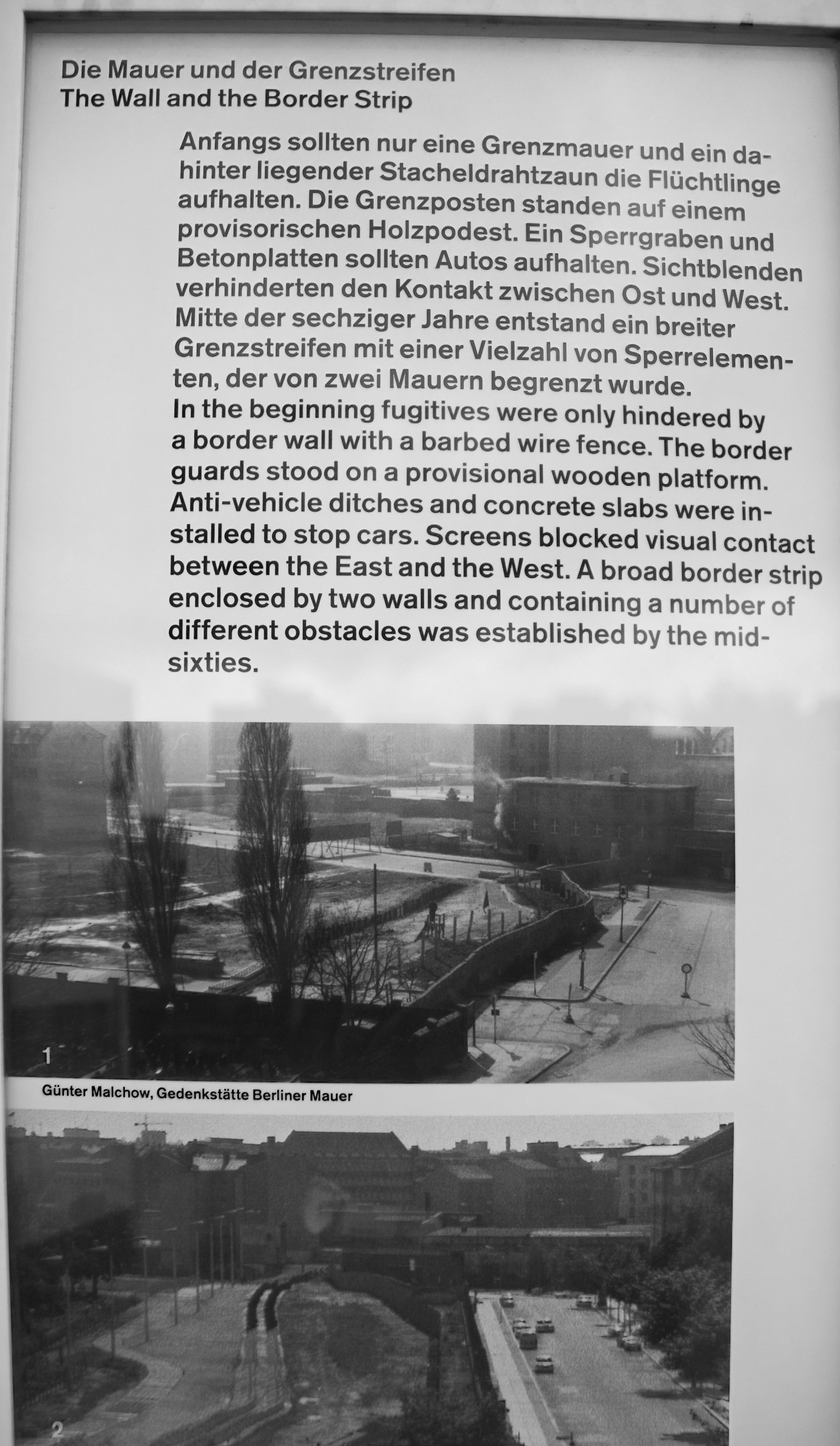
The Berlin Wall Construction began on The Berlin Wall early in the morning of Sunday, August 13, 1961. It was a desperate – and effective - move by the GDR (German Democratic Republic) to stop East Berliners escaping from the Soviet-controlled East German state into the West of the city, which was then occupied by the Americans, British and French. Berlin's unique situation as a city half-controlled by Western forces, in the middle of the Soviet Occupation Zone of Germany, made it a focal point for tensions between the Allies and the Soviets and a place where conflicting ideologies were enforced side-by-side. However, as more and more people in the Soviet-controlled East grew disillusioned with communism and the increasingly oppressive economic and political conditions, an increasing number began defecting to the West. By 1961 an estimated 1,500 people a day were fleeing to the West, damaging both the credibility and - more importantly - the workforce of the GDR. Soon rumours began to spread about a wall, and it wasn’t long after that those rumours were made a concrete reality. In a masterfully-planned operation, spanning just 24 hours, the streets of Berlin were torn up, barricades of paving stones were erected, tanks were gathered at crucial places and subways and local railway services were interrupted, so that within a day the West of Berlin was completely sealed off from the East. As of that same day inhabitants of East Berlin and the GDR were no longer allowed to enter the West of the city (including the 60,000 who had been commuters). In response to international criticism that such drastic measures inevitably drew, the GDR claimed that the barricade had been raised as an ‘anti-fascist protection wall’, and that they had moved to prevent a third world war. |
| Datum | |
| Quelle | The Berlin Wall |
| Urheber | Berit from Redhill/Surrey, UK |
| Kameraposition |  | Dieses und weitere Bilder auf OpenStreetMap |  |
|---|
.jpg¶ms=052.508691_N_0013.381519_E_globe:Earth_type:camera_source:Flickr_&language=de)
Lizenz


- Dieses Werk darf von dir
- verbreitet werden – vervielfältigt, verbreitet und öffentlich zugänglich gemacht werden
- neu zusammengestellt werden – abgewandelt und bearbeitet werden
- Zu den folgenden Bedingungen:
- Namensnennung – Du musst angemessene Urheber- und Rechteangaben machen, einen Link zur Lizenz beifügen und angeben, ob Änderungen vorgenommen wurden. Diese Angaben dürfen in jeder angemessenen Art und Weise gemacht werden, allerdings nicht so, dass der Eindruck entsteht, der Lizenzgeber unterstütze gerade dich oder deine Nutzung besonders.

|
Dieses Bild wurde ursprünglich auf Flickr veröffentlicht und am 6. Februar 2013 vom Administrator oder vertrauenswürdigen Benutzer File Upload Bot (Magnus Manske) überprüft. Die Überprüfung ergab, dass das Bild zum Zeitpunkt der Überprüfung auf Flickr mit der oben genannten Lizenz markiert war. | 
|
Dateiversionen
Klicke auf einen Zeitpunkt, um diese Version zu laden.
| Version vom | Vorschaubild | Maße | Benutzer | Kommentar | |
|---|---|---|---|---|---|
| aktuell | 14:31, 6. Feb. 2013 | | 2.209 × 3.802 (3,77 MB) | wikimediacommons>File Upload Bot (Magnus Manske) | Transferred from Flickr by User:russavia |
Dateiverwendung
Die folgende Seite verwendet diese Datei:
.jpg)