Datei:Amazon River Delta (MODIS 2018-10-26).jpg

Beschreibung
| Beschreibung |
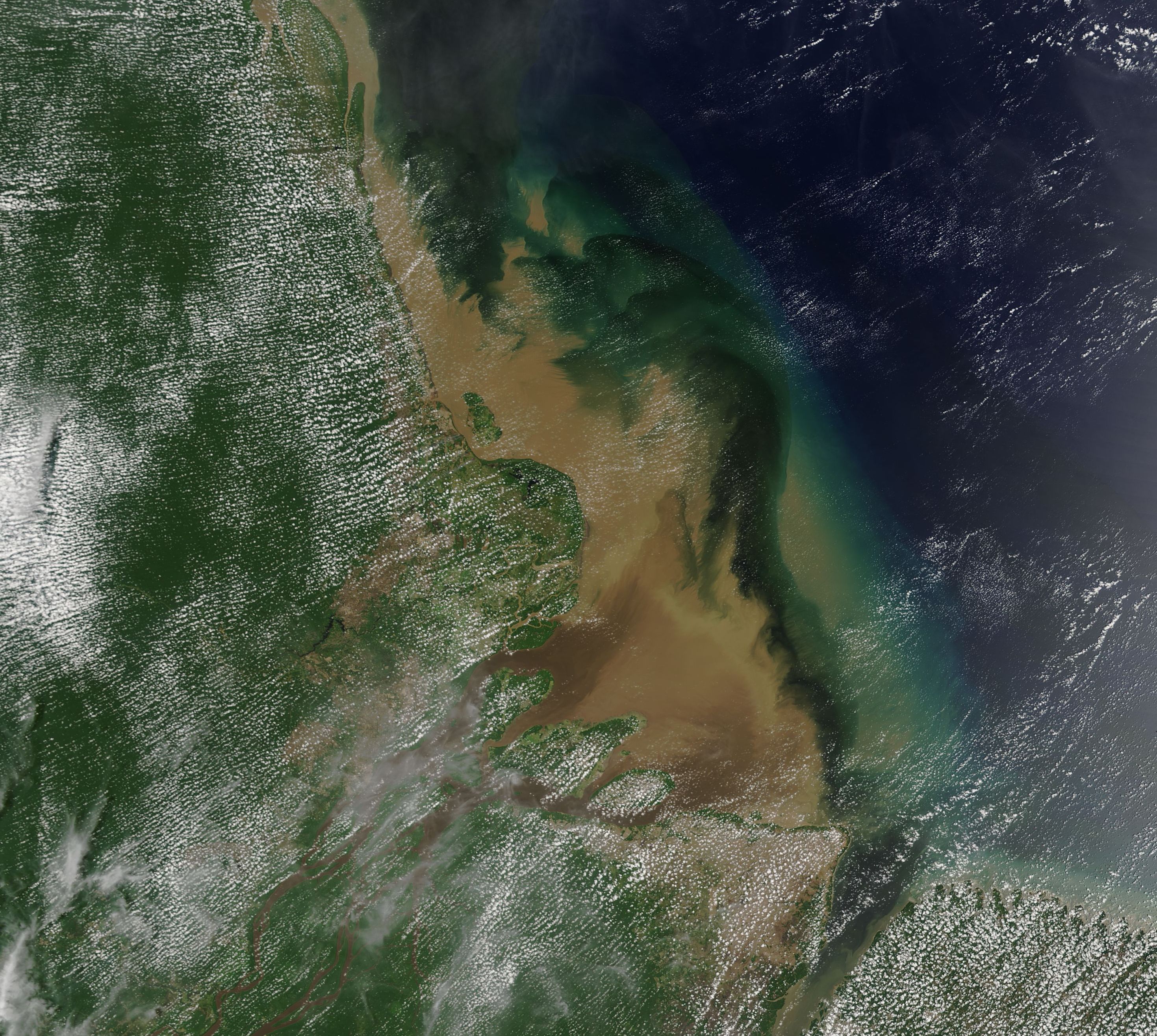
English: On October 14, 2018, NASA’s Aqua satellite passed over northern Brazil, allowing the Moderate Resolution Imaging Spectroradiometer (MODIS) on board to acquire a stunning true-color image of sediment pouring from the Amazon River Delta into the Atlantic Ocean.
The Amazon River is the world’s largest river in terms of water discharge and it wins that place by a large margin. According to the US Geological Survey (USGS) Delta Research and Global Observation Network (DRAGON), the Amazon has a mean discharge ten times that of the Mississippi and five times that of the next largest river, the Congo, located in Zaire. The Amazon Basin drains 2.67 million square miles (6.9 million square kilometers), more than a third of the total area of South America, and receives more than half (52%) of the daily precipitation for the continents. By the time the long, winding river passes from the Andes and travels about 4,000 miles (6,400 km) to the wide delta on the coast of Brazil, the waters have collected a lot of sediment – enough to make the river appear a muddy brown. In this image, the dark greens mark areas of heavy vegetation, which is primarily Amazon Rain Forest. A spotty layer of “popcorn” clouds float above the forest. This type of cloud is formed by condensed water vapor released by plants and trees during a sunny day, and is common during the Amazon’s dry season. The sediment-laden water appears dark brown as it flows from the Delta and into the open ocean. As the sediment pours into the blue ocean, it begins to sink. As it goes further under water the color changes—first to a light tan and then, eventually, to swirls of green. |
||
| Datum | Aufgenommen am 14. Oktober 2018 | ||
| Quelle |
Amazon River Delta (direct link)
|
||
| Urheber | MODIS Land Rapid Response Team, NASA GSFC |


.jpg)
 |
This media is a product of the Aqua mission Credit and attribution belongs to the mission team, if not already specified in the "author" row |
Lizenz

|
Diese Datei ist gemeinfrei (public domain), da sie von der NASA erstellt worden ist. Die NASA-Urheberrechtsrichtlinie besagt, dass „NASA-Material nicht durch Urheberrecht geschützt ist, wenn es nicht anders angegeben ist“. (NASA-Urheberrechtsrichtlinie-Seite oder JPL Image Use Policy). |  |
 |
Warnung:
|
Dateiversionen
Klicke auf einen Zeitpunkt, um diese Version zu laden.
| Version vom | Vorschaubild | Maße | Benutzer | Kommentar | |
|---|---|---|---|---|---|
| aktuell | 03:25, 17. Feb. 2024 | | 2.938 × 2.631 (1,53 MB) | wikimediacommons>OptimusPrimeBot | #Spacemedia - Upload of http://modis.gsfc.nasa.gov/gallery/images/image10262018_250m.jpg via Commons:Spacemedia |
Dateiverwendung
Die folgende Seite verwendet diese Datei:
.jpg)